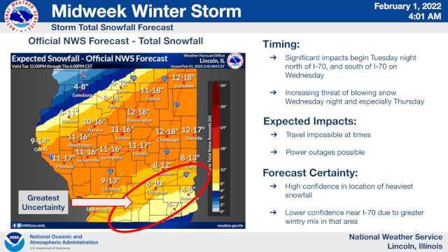
Now 8-12 Inches of Snow Possible in Effingham

Published on February 1 2022 10:16 am
Last Updated on February 1 2022 3:14 pm
Written by Greg Sapp
The Effingham area could be visited by eight to 12 inches of snow from Wednesday to Thursday.
The National Weather Service office in Lincoln this morning indicated that there is still some uncertainty over the total for our region. The uncertainty is due to the exact track of the storm, but the system has begun to shift farther south. The shift indicates that the Effingham area will receive more snow than first expected, and less ice accumulation.
Original estimates were for a quarter-inch of ice in our area, but it now looks like we will receive less than a tenth-inch of ice. The Weather Service is indicating that the more sleet and ice we receive, the less snowfall. Less ice and sleet would indicate a greater snowfall total for our area.
The largest amount of snowfall for our part of the state is likely later on Wednesday and into Thursday.
We will keep you up-to-date.